Smart Waste Management with GIS
1. Introduction:
Waste management entails the responsible collection, processing, and disposal of waste materials with a focus on environmental preservation. Its core objectives include waste reduction, resource recovery, and the minimization of landfill or incineration. This is facilitated through various strategies such as waste reduction initiatives, efficient collection and transportation methods, segregation and sorting practices, recycling and resource recovery efforts, treatment and disposal processes, utilization of waste-to-energy technologies, and fostering public awareness and education campaigns.
2. Smart Waste Management with GIS
Smart Waste Management utilizes Geographic Information Systems (GIS) to revolutionize waste collection, monitoring, and management in smart cities. GIS enables authorities to optimize waste collection routes by integrating geographical data with real-time waste generation rates, resulting in reduced travel time, fuel consumption, and carbon emissions from collection vehicles. This approach fosters efficiency and sustainability while achieving cost savings and mitigating environmental impact. GIS’s spatial analysis and visualization tools aid in site selection, route optimization, asset management, environmental assessment, waste generation monitoring, public engagement, and emergency planning. Integration of GIS enhances decision-making, efficiency, and sustainability in waste management through informed strategies based on spatial data.
All these processes can be done using the very own advanced Remote Sensing & GIS technology of India, IGiS (Indigenous GIS and Image Processing Software). The Enterprise based solution of IGiS is highly capable of creating, storing, managing, and analyzing various geospatial datasets, to extract insightful information from them.
Following are the major innovative solutions that can be achieved using IGiS Technology in Smart waste Management:
• Smart Planning
• Smart Management
• Monitoring and Analysis
» Smart Planning:
Smart waste management planning utilizing GIS (Geographic Information Systems) integrates advanced technology and spatial analysis to optimize waste collection, disposal, and recycling processes.
- I. Spatial Analysis: IGiS is a comprehensive platform that seamlessly combines various spatial datasets, offering interactive visualization and analysis functionalities. Through its spatial analysis tools like multi-criteria evaluation i.e. weighted overlay analysis, considers the evaluation of important factors such as population density, transportation networks, and total households. This empowers stakeholders to actively engage in site selection and conduct scenario analysis to determine the best solutions. By providing interactive tools for spatial analysis and visualization, IGiS greatly improves the effectiveness, transparency, and inclusiveness of the decision-making process.
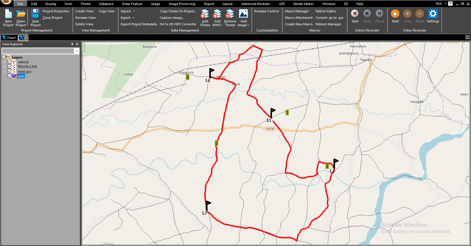
- II. Route Optimization: IGiS optimizes waste management routes by utilizing network analysis tools and GIS capabilities. It incorporates network analysis to determine efficient routes considering road networks and traffic conditions. Waste management planners can generate optimized routes based on criteria like waste sources, schedules, and service boundaries. An advanced network planning tool supports providing optimized routes considering multiple destinations based on the shortest distance & running cost, reducing the maintenance cost & travel time.
- III. Integration with weighing IoT Sensors & Alert Generation
Integration of various smart waste weighing machines with the GIS System can aid in smart waste management by visualizing the alerts over a Web GIS map. This integration allows decision-makers to strategize waste collection routes based on real-time data.
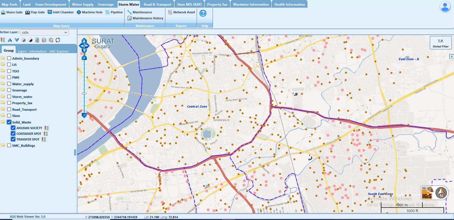
- IV. Public Engagement: The IGiS platform provides interactive maps and applications for public engagement and education. Citizens can access information on waste collection schedules, recycling locations, and environmental initiatives, fostering community involvement in sustainable waste management practices.
» Smart Management
Smart asset management and vehicle tracking are integral components of smart planning for waste collection, contributing to enhanced efficiency, cost-effectiveness, and sustainability in waste management processes.
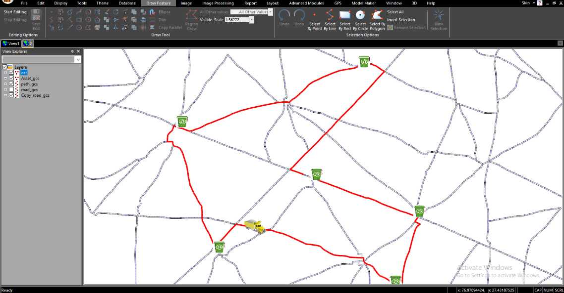
I. Vehicle Tracking: The implementation of vehicle tracking through the IGiS Tracking Analyst tool improves waste management by optimizing routes, and enabling real-time monitoring. The real-time update of the alerts supports the identification of the location requiring immediate cleaning. With the GIS-based Vehicle Tracking System, the closest vehicle can be assigned to the specified location for waste collection. Subsequently, the optimized route navigation can be displayed on the vehicle’s installed device.
II. Asset Management: With its geospatial capabilities, IGiS provides valuable assistance in waste management-related asset management. It enables spatial analysis, e.g. heat map, of waste generated, disposal, and recycling patterns, allowing for the identification of areas with high waste accumulation and evaluation of existing waste management systems. By utilizing IGiS, waste collection points, recycling centres, and disposal sites can be strategically planned to optimize efficiency. Furthermore, IGiS optimizes waste collection routes in real-time, leading to reduced fuel consumption and enhanced operational effectiveness. Additionally, IGiS fosters public engagement through user-friendly web portals and mobile applications.
» Monitoring and Analysis
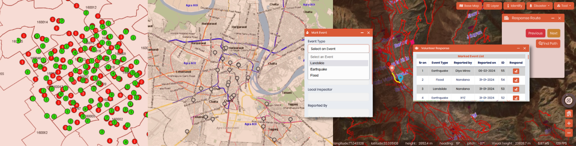
IGiS plays a crucial role in monitoring and analysing waste management systems. It enables real-time monitoring of waste-related activities and integrates data from various sources for centralized tracking. Conducting spatial analysis, while identifying areas with high waste generation, it optimizes resource allocation by means of providing fastest response route through real-time data ingestion. IGiS facilitates performance evaluation through reports, charts and visualizations, and can predict future waste trends. Overall, IGiS enhances decision-making, resource optimization, and continuous improvement in waste management practices.
3. Conclusion
IGIS offers a range of benefits, including enhanced communication and decision-making through visualizations and maps. It possesses the capacity to identify and address potential issues in their early stages, enabling the implementation of proactive measures. Moreover, through seamless integration with various systems, IGIS enhances situational awareness and response capabilities, further empowering organizations to effectively manage and mitigate risks pertaining to smart waste management system. Ultimately, IGIS assumes a crucial role in fortifying the safety and resilience of a given application field, thus contributing significantly to its overall well-being.
Latest Blog
Spatial enablement of real time data and its Applications
In the modern world of Artificial intelligence and virtual reality, although slowly and steadily, real time data ingestion is now becoming a mandate. Although extracting complex insights in real time....
Read More