North Eastern Space Applications Centre (NESAC)
Client
North Eastern Space Applications Centre (NESAC)
North Eastern Space Applications Centre (NESAC)
Website
https://nesac.gov.in/
https://nesac.gov.in/
Location
Umiam, Meghalaya
Umiam, Meghalaya
Industry
Government
Government
Project
Design and Development of Software Application for North Eastern
Spatial Data Repository (NeSDR)
on IGiS Platform for North Eastern Region (NER)
Spatial Data Repository (NeSDR)
on IGiS Platform for North Eastern Region (NER)
Organization profile
North Eastern Space Applications Centre (NESAC), Meghalaya was established as a joint initiative of the Department of Space (DOS) and the North Eastern Council (NEC) to provide space technology inputs for developmental planning of NE region.
Objective
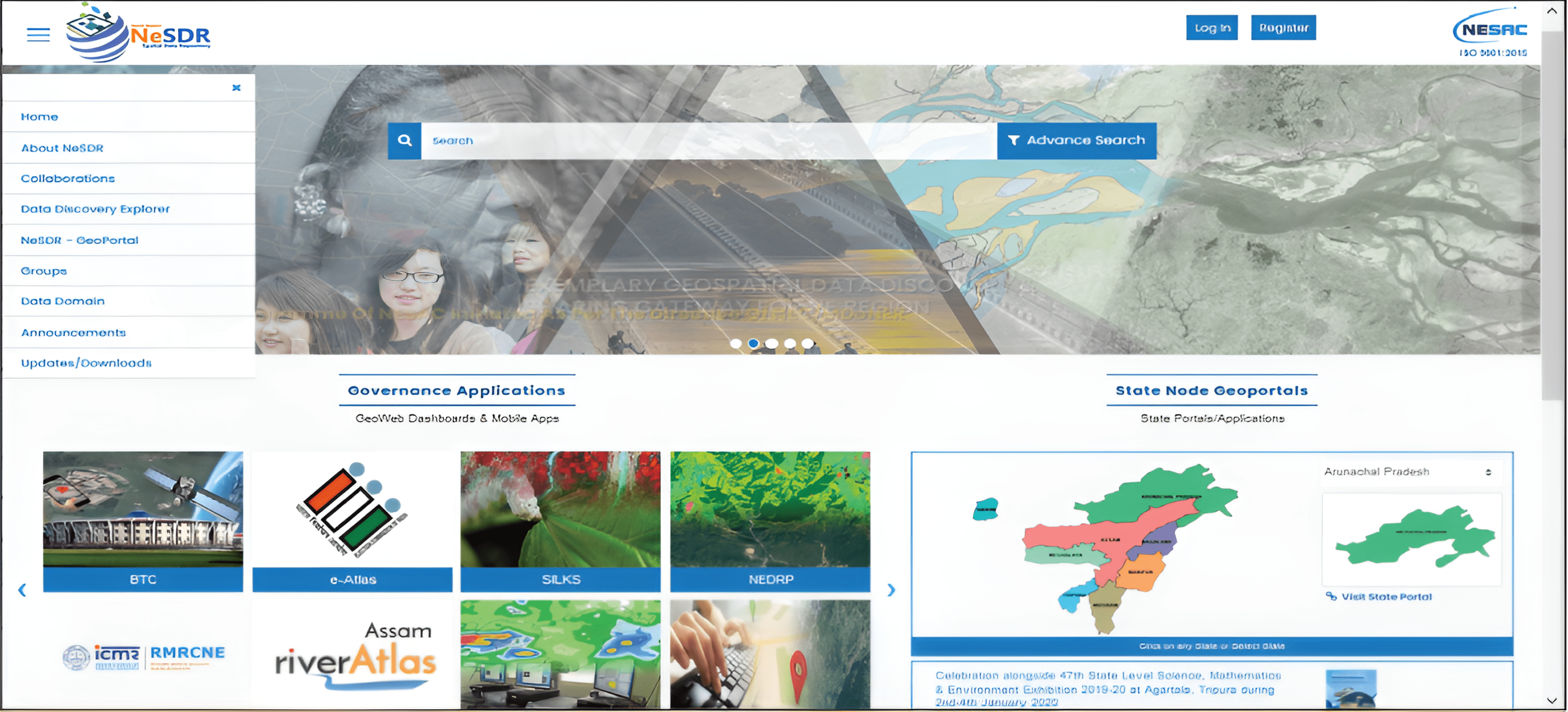
The objective of the solution is to create a data repository at NESAC as a regional node with a linkage to all respective state nodes of NER.
Solution
- The major contribution in the NeSDR is to develop a spatial data repository on IGiS-MDMS (Metadata management system) to store, manage, publish, register, and securely distribute geospatial data by adopting a service-oriented architecture as defined by NESAC.
- It facilitates data & metadata publishing, cataloguing, discovery, harvesting, and administration. The OGC compliant web services are exploited to establish this data repository.
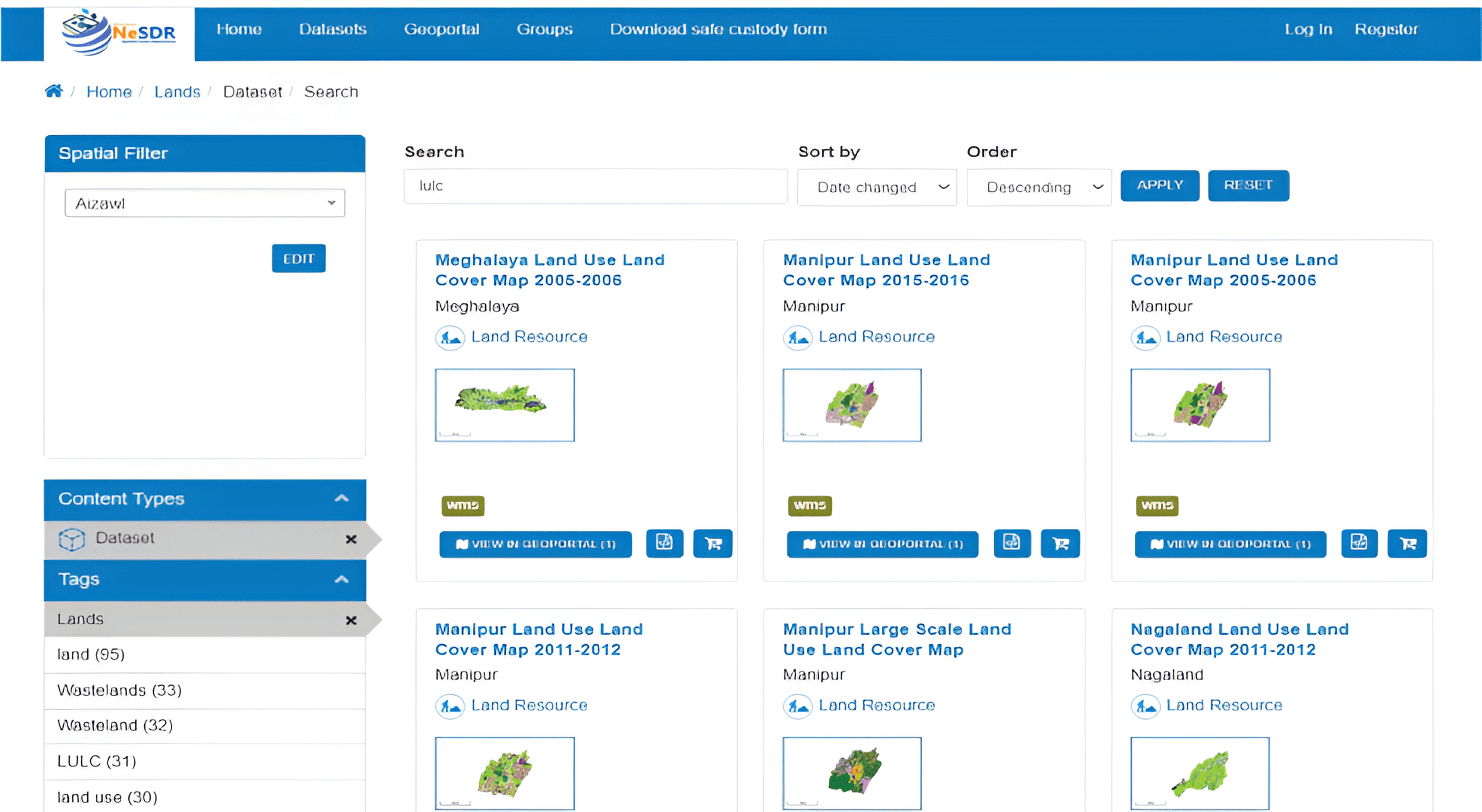
- The data catalogue is populated with various geospatial datasets of NER covering land, water, and soil resources, bio diversity, utility maps, infrastructure, socio-economic data, planning inputs, and disaster management support inputs, etc.
- Data along with metadata from state centers are crawled to the central database. The harvested data is published for the use of authorised entities.
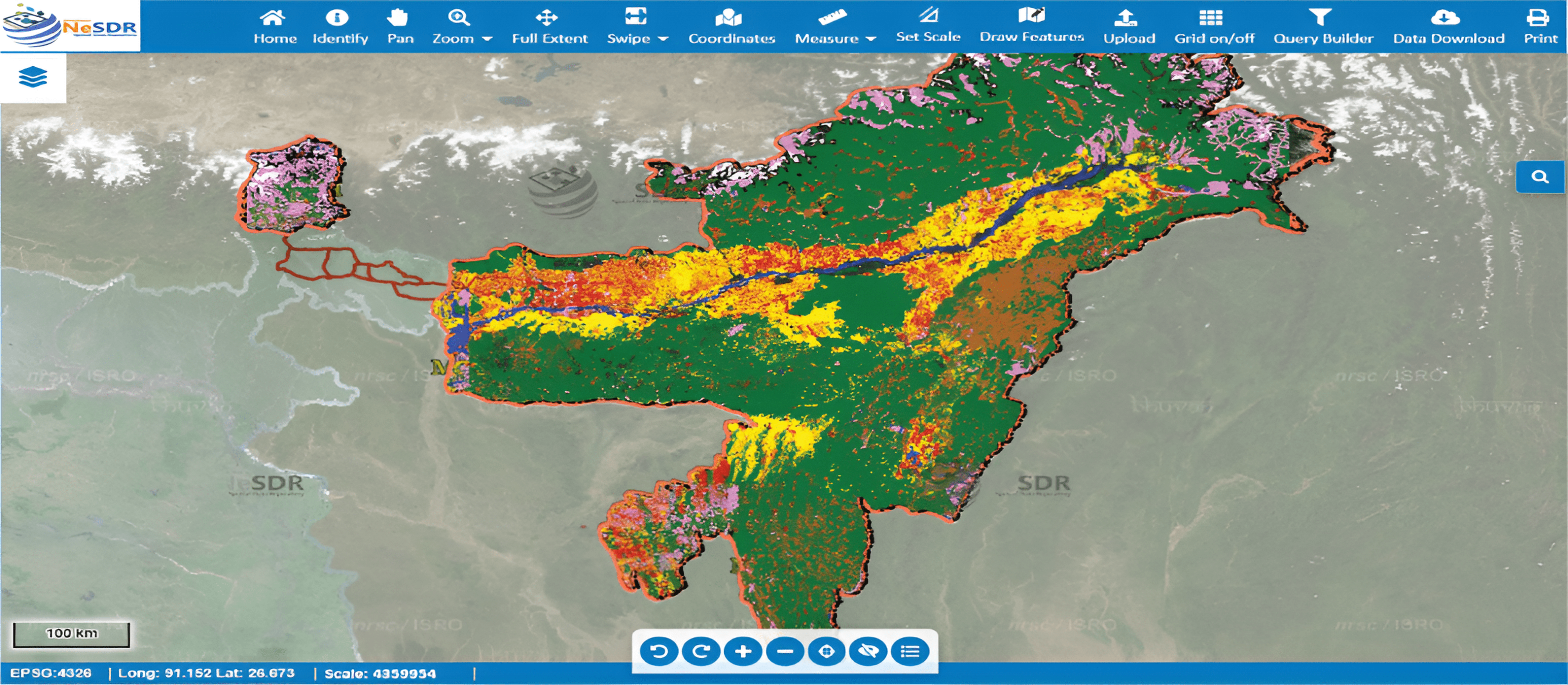
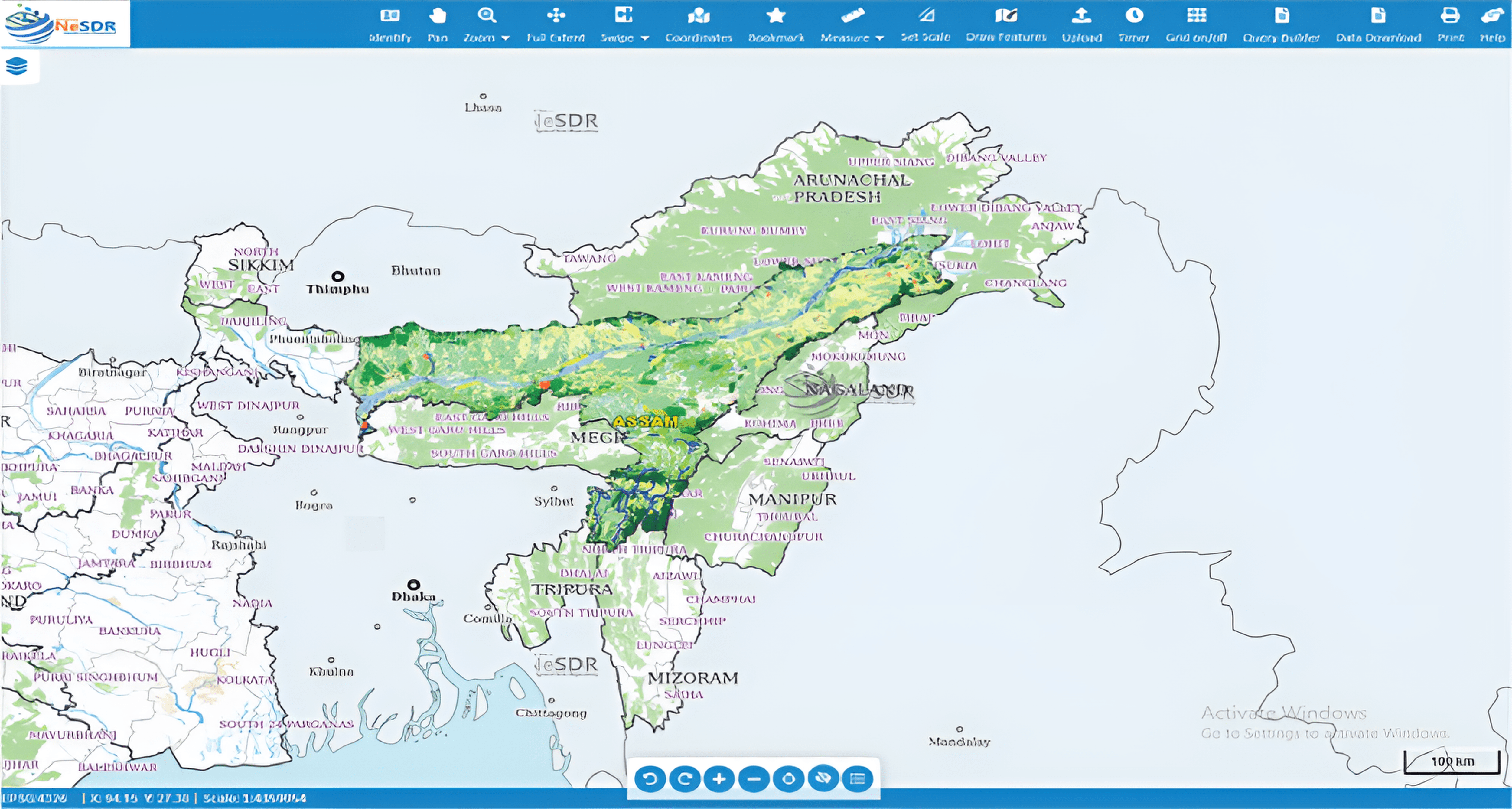
- The portal gives functionalities like the addition of various base maps, swipe tool, measurement tool, spatial filter based searching, SQL based query to authorised users.
- It allows the authorised user to download data by defining AOI and clip functionality.
- The portal allows data discovery based on the format of the data, metadata, tags, and spatial filters.
- It provides a summary and count of themes and type of datasets on the home page of the portal.
IGiS-MDMS Capabilities
- Service oriented architecture (SOA) for management of data, metadata, services and application.
- Adhering to geospatial standards such as ISO/OGC/INSPIRE. Interoperable Standard driven solution.
- Single solution for geospatial data creation, processing, publishing, and sharing.
- Facilitate cartographic representation using inbuilt symbology and rich map publishing features.
- User-friendly data registry management to classify huge data set in diversified catalogues.
- Geoportal for data discovery, visualization, analysis, and downloading for different stakeholders.
- IGiS-MDMS facilitates a geospatial framework for GIS application development.
Benefits
- It will allow people to catalog data and to share it among the line departments for the benefit of NESAC and northeast states (i.e. Arunachal Pradesh, Assam, Manipur, Meghalaya, Mizoram, Nagaland, Sikkim & Tripura).
- Data cataloging server software application has helped to decentralize data cataloging and sharing of those data.
- Creating data once and then using it multiple times for various applications.
- Immediate availability of spatial data in times of disaster supports mitigation and rebuilding activities.
- Most of the Spatial Data generated by the government agencies is accessible to all state authorities.
About SGL
Scanpoint Geomatics Ltd. is the leader in the Indian Geomatics Industry. We pioneer the nation’s geospatial domain through IGiS- An indigenous technology that brings GIS, Image Processing, Photogrammetry, and CAD together on the same platform under the Make in India Initiative.
We are proud of our partnership with the Indian Space Research Organisation (ISRO). With an innovative approach and over two decades of rigorous research and development, the duo developed the IGiS platform. Backed by ISRO’s domain expertise, we aim to push forth innovation and uplift the global geospatial domain.