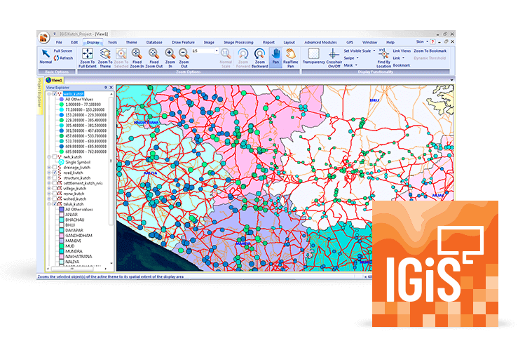
IGiS - GIS & IP Enterprise Suite

A Scalable GIS Platform for Your Organisation.

IGiS Enterprise
IGiS- IP Enterprise Suite

IGiS Enterprise is a powerful geospatial suite with feature-rich tools to help you create, analyse, manage and securely share geospatial data over the Internet and intranet. Key Components of IGiS Enterprise suite like Desktop, Server, Publisher, Web, Mobile, widget, CAD and SDK along with OGC Services are used to provide end-to-end enterprise geospatial solutions. Service-Oriented Architecture (SOA) coupled with OGC compliant services and key components make IGiS Enterprise the most powerful geospatial suite in the GIS industry.

Share, Manage, and Distribute data with IGiS Server

IGiS Server is used to publish and manage geospatial data including imagery and applications. Users can create different services to share this geospatial data and applications over the intranet and Internet across different platforms. IGiS server supports OGC services for Geospatial data, metadata, and processing. It provides comprehensive spatial data infrastructure that extends over desktop, web and mobile platforms.

IGiS Desktop

Create, Process, and Analyse data with IGiS Desktop

IGiS Desktop is used for conceptualisation, production, dissemination and study of 2D and 3D maps with cartographic and visualization tools. IGiS Desktop has integrated GIS and Image Processing capabilities along with advance extensions for performing analysis of geospatial data. Using IGiS Publisher users can publish their data and services on IGiS Server with a single click.

Create and Upload data with IGiS Web

IGiS provides an extensive web platform to put your geographic information on the web. It provides a wizard for creating web applications quickly. Users can use different platforms like .Net, PHP, Python and Java for developing Web-GIS application. Using IGiS Web platform users can access data, metadata, and process services from the GIS server.

IGiS Web
IGiS data

Capture, Edit, and Display data with IGiS Mobile

IGiS mobile application can capture, edit and display GIS data quickly and accurately from any location using the GPS enabled mobile device. It supports satellite-based augmentation (SBAS) for improved location accuracy while capturing data. It provides flexibility as well as enhanced field productivity through customised form and online/offline access to GIS Server. Users can access various OGC services for seamless Geospatial experience.

Convert and Digitize data with IGiS CAD

IGiS CAD enables 2D and 3D mapping support with cartographic as well as engineering capabilities to map real world objects. IGiS CAD is fast and comprises of numerous user friendly tools for any kind of GIS data conversion and digitization. Using Coordinate Geometry (COGO) descriptions, users can accurately create features from any engineering drawing sources and geo-reference them into the GIS database.

IGiS CAD
IGiS SDK

Create complex applications with IGiS SDK

The IGiS Enterprise Developer Kit allows you to build custom software solutions. IDE, COM controls and extensive APIs in various programming languages empower developers to create custom objects, complex applications and complete vertical solutions.

Visualize, Manage, and Secure data with OGC Compliance

IGiS provides OGC Services, which complies with various maps, data, metadata and processing standards. It enables interoperability for visualising, analysing, publishing, managing data and secure access by providing user management and collaboration. The OGC standards empower technology developers to consume complex spatial information and services with all kinds of applications.

IGiS Data Software
IGiS Network

Network Analyst

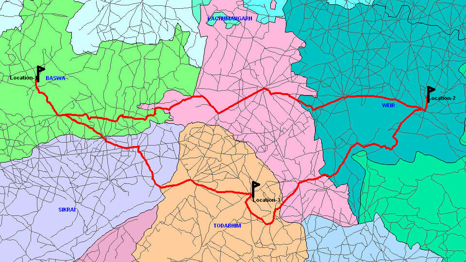
IGiS Network Analyst is a network-based Geospatial analysis tool to resolve complex routing issues. Users can plan routes for an entire fleet, get directions and trace facilities. Major functions of the network analyst are Defining Network Rules, Applying Turn Impedances, Add Network Location, Find Shortest Path and single as well as Multi-Location Analysis.

Tracking Analyst

IGiS Tracking Analyst module is used to animate, track, and relate the data which are changing with respect to time and space. It is capable to play temporal data at different speeds in forward and reverse direction in real time. User can analyse the dynamic patterns in a temporal and spatial manner with an interactive GUI for animation facility.

IGiS Tracking
IGiS 3D Software

3D Analyst

IGiS 3D Analyst module provides functions for 3D viewing and terrain navigation along with the facility for adding 2D/3D objects. It provides various type of analyses like elevation profiling, Line of Sight, shadow, viewshed analysis, VR Display, height contour, sky line, line profile, terrain excavation, terrain exaggeration and many more. Users can also create a navigation path along the terrain to understand terrain topography. An advanced camera setting tool allows users to set the eye and look at the position as well as the velocity of navigation.

Neural Network Analyst

Neural Networks are systems, which mimic the computational abilities of biological systems by using simple, interconnected artificial neurons. A neuron is the fundamental building block of the nervous system. Artificial neurons are simple emulation of biological neurons. They take input, perform a very simple operation on this data and pass the result on to other artificial neurons. This module provides neural network based Supervised and Unsupervised image classification.

IGiS Software
IGiS Hyperspectral Analyst

Hyperspectral Analyst

Hyper-spectral Tools performs analysis on Hyperspectral Images. IGiS hyperspectral analyst contains various tools to calculate Internal Average Relative Reflectance (IARR), Auto IARR, Log Residuals, Auto Log Residuals, Normalize, Rescale, Spectrum Average, Signal to Noise and Mean per Pixel. Advanced Hyperspectral tool provides functionalities, which can be used in the field of agriculture, urban planning, object identification and many more.

Terrain Analyst

Terrain Analyst module involves the acquisition, manipulation, processing, and analysis of elevation data. Terrain analysis is extensively used by various sectors such as Telecom, Defence, Urban, water resources etc. for the processing of elevation data. The important terrain analysis functions are DEM to Contour, Slope/Aspect, Hill Shade, Cut & Fill Analysis, Line Profile, Line of Sight, View-shed, Best Path, DEM Area/Volume Calculation, Anaglyph and Route inter-visibility and many more.

IGiS Terrain analyst
IGiS - GIS Analyst

Raster GIS Analyst

Raster GIS Analysis Works with Pixels/cells instead of Points, Lines, Polygons. Raster GIS analyst is well suited for modelling complex processes and allows operations such as raster algebra, hydrologic modelling, distance tools, proximity analysis, zonal analysis, and weighted overlay. It is broadly used for the purpose of distance analysis, corridor analysis, hydrological analysis, and many more.

Hydrology Analyst

IGiS hydrology extension gives you hydrologic modelling tools that enable you to work with hydrologic data to identify the flow direction, determine flow accumulation, identify sinks, outline watersheds and create networks. You can create and analyse groundwater data flow and its constituents.

IGiS Module
IGiS Analyst

MET GIS Analyst

Meteorological GIS (MetGIS) is designed and developed to process meteorological satellite data such as Kalpana-1, INSAT-3A, and INSAT 3D. Met-GIS module can handle customize HDF5 data to view the attributes, data info, and image preview. Met-GIS has a rich set of functions to create T-Phi Gram from Kalpana-1, INSAT-3A, and INSAT 3D. T-Phi gram calculates temperature, dew point temperature and parcel curve using sounder data. Image Prediction Model of Met-GIS enables to predict the next satellite images as per specified time based on the previous six satellite images. It has also a tool for wind vector generation using WVW, IRW, VSW, and MRW file of INSAT-3D Image data.

Schedule a Demo

For any inquiries or details, reach out to hello@sgligis.com - we'd love to hear from you!

Lets Talk

Icon

+91 (880-088-2559)