IGiS - Photogrammetry Suite
Fully automated geodesy and Photogrammetry tools for image to 3D.
Explore MoreIGiS - CAD
Effortless 2D drafting & 3D modelling suite with a unique combination of designing, engineering and cartographic capabilities.
Explore MoreIGiS Extensions
Enhanced performance with Advanced Extensions
Network Analyst
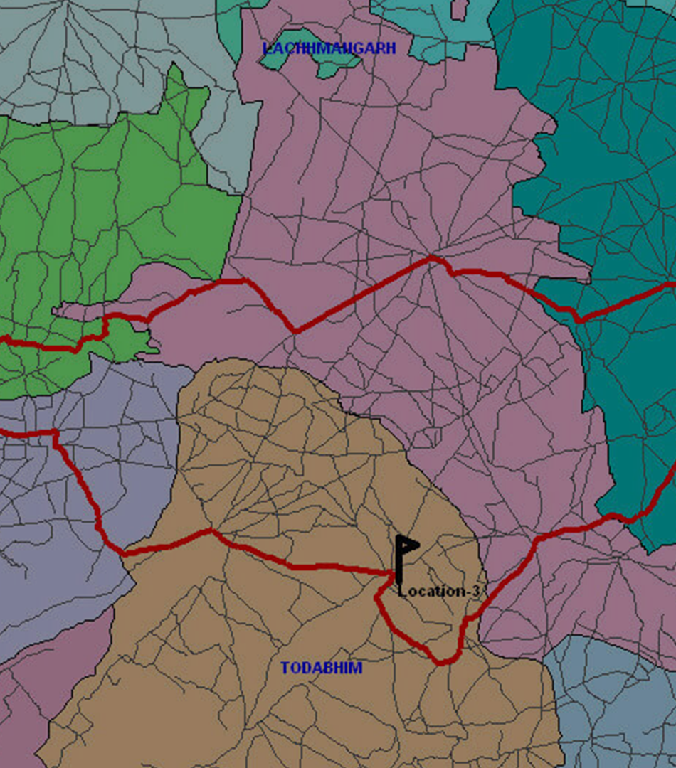
IGiS Network Analyst is network based Geospatial analysis tools to resolve complex routing issues. User can plan routes for an entire fleet, calculate directions and trace facilities. It is used to find the shortest and optimum path by defining the network rules. Major functions of network are Defining Network Rules, Applying Turn Impedances, Add Network Location, Find Shortest Path, Location Analysis and Multi Location Analysis.
![]()
Tracking Analyst
IGiS Tracking Analyst module is used to animate, track and relate the data which are changing with respect to time and space. It is capable to play real time temporal data at different speeds in forward and reverse direction. User can analyse the dynamic patterns in temporal and spatial manner with interactive GUI for animation facility
3D Analyst
IGiS 3D Analyst module provides functions for 3D Viewing and terrain Navigation. IGiS-3D module provides terrain viewing functions in 3D along with the facility for adding 2D/3D objects. IGiS-3D module is a rich set of tools for various terrain analyses like elevation profiling, Line of sight and view shed analysis. User can create navigation path along the terrain to understand terrain topography. Advanced camera setting tool allows user to set the eye and look at position as well as velocity of navigation.
Neural Network Analyst
Neural Networks are systems, which mimic the computational abilities of biological systems by using simple, interconnected artificial neurons. A neuron is the fundamental building block of nervous system. Artificial neurons are simple emulation of biological neurons; they take input into, perform very simple operation of this data and relatively pass the result on to other artificial neurons. The software supports the following classification in the Neural Network Module such as Supervised and Unsupervised.
Hyperspectral Analyst
Hyper-spectral Tools performs analysis on Hyperspectral Images. IGiS contains various hyper-spectral analysis tools to calculate Internal Average Relative Reflectance (IARR), Auto IARR, Log Residuals, Auto Log Residuals, Normalize, Rescale, Spectrum Average, Signal to Noise and Mean per Pixel. Advanced Hyper-spectral tool provides functionalities in the field of agriculture, urban planning, object identification, and many more.
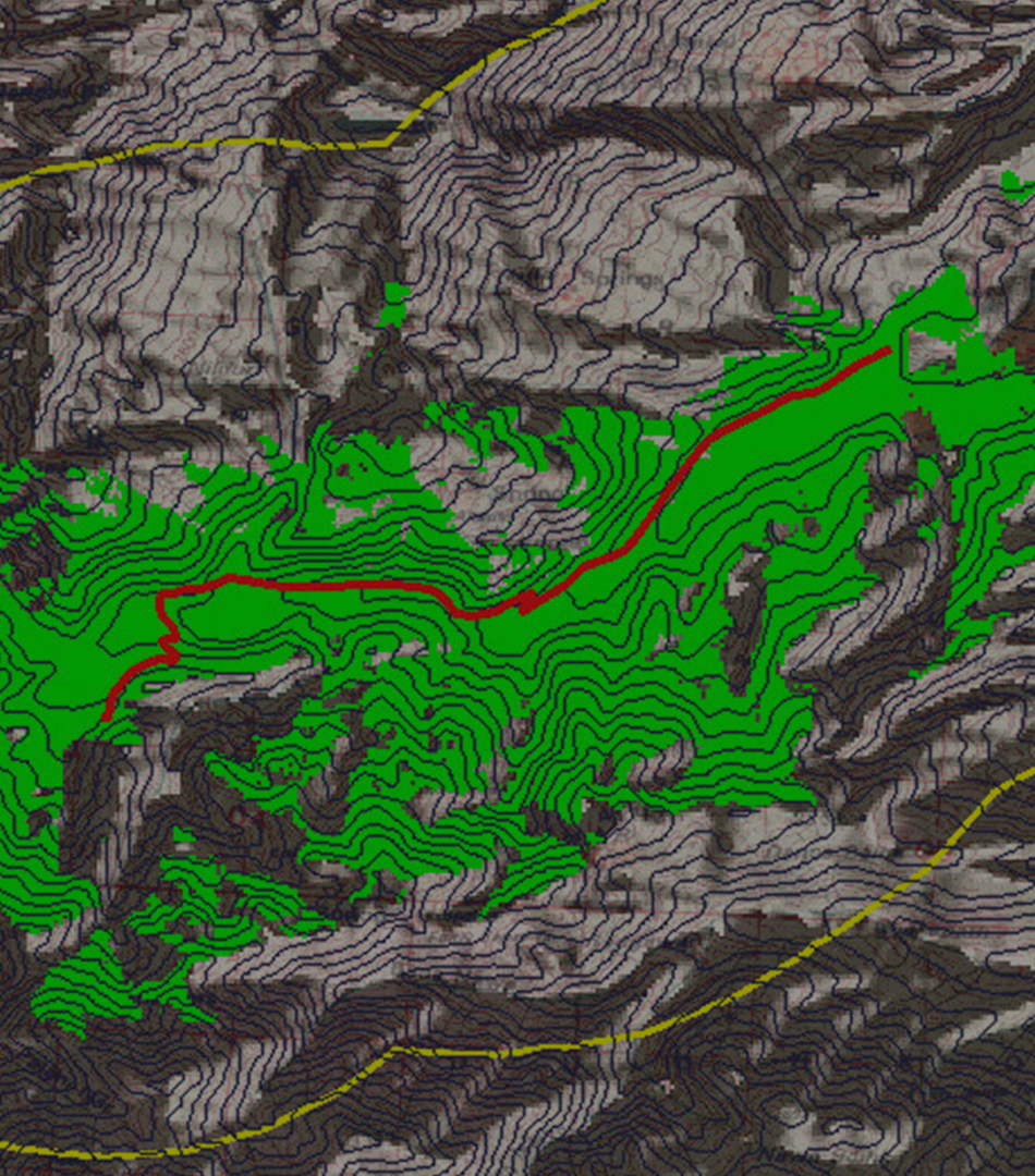
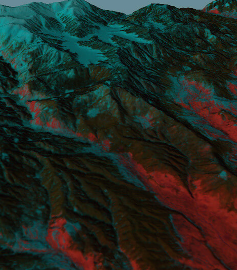
Terrain Analyst
Terrain Analyst module involves the acquisition, manipulation, processing and analysis of elevation data. Terrain analysis is extensively used by various sectors such as Telecom, Defence, Urban, etc. for the processing of elevation data. The important terrain analysis functions are DEM to Contour, Slope/Aspect, Hill Shade, Cut & Fill Analysis, Line Profile, Line of Sight, View-shed, Best Path, DEM Area/Volume Calculation, Anaglyph and Route inter-visibility and many more.
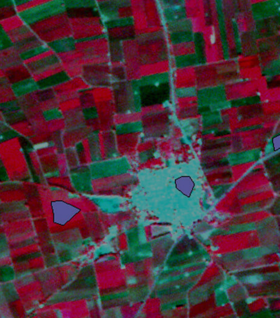
Raster GIS Analyst
Raster GIS Analysis Works with Pixels/cells instead of Points, Lines, Polygons. Raster GIS is well suited for modelling complex processes and allows operations such as raster algebra, hydrologic modelling, distance tools, proximity analysis, zonal analysis, and weighted overlay. Raster GIS module broadly used for Distance analysis, corridor analysis, hydrological analysis and many more.
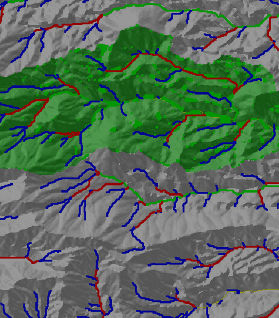
Hydrology Analyst
IGiS hydrology extension gives you hydrologic modelling tools that enable you to work with hydrologic data to identify the flow direction, determine flow accumulation, identify sinks, outline watersheds and create networks. You can create and analyse groundwater data flow and its constituents.
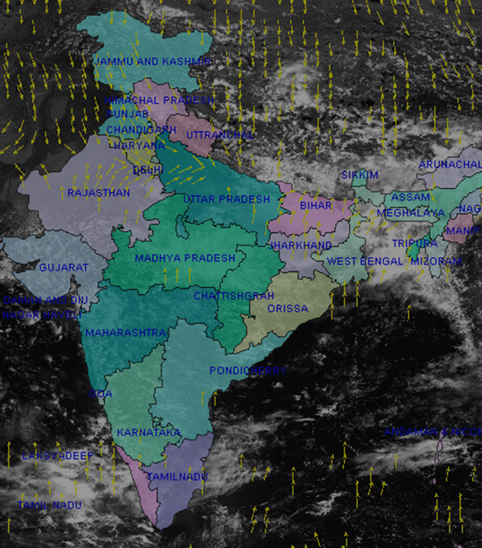
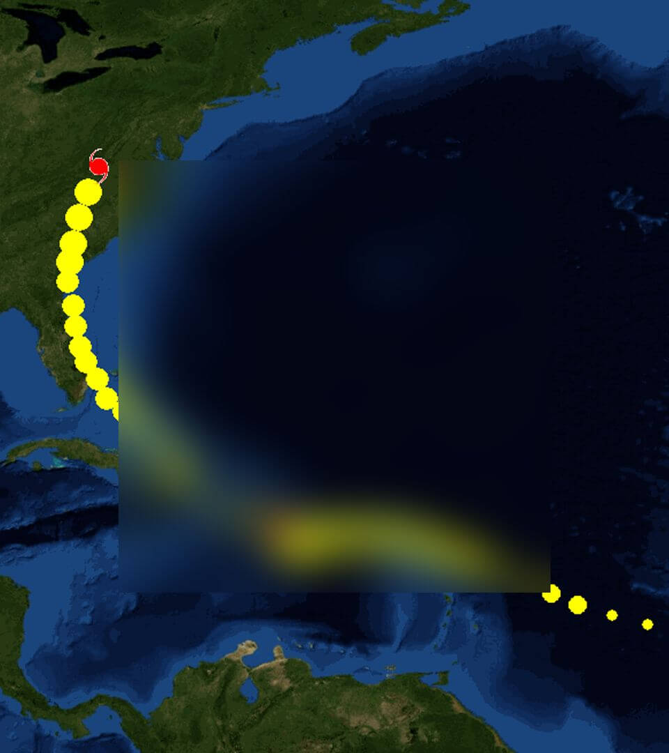
MET GIS Analyst
Meteorological GIS (MetGIS) is designed and developed to process meteorological satellite data such as Kalpana-1, INSAT-3A, and INSAT 3D. Met-GIS module can handle customize HDF5 data to view the attributes, data info, and image preview. Met-GIS has a rich set of functions to create T-Phi Gram from Kalpana-1, INSAT-3A, and INSAT 3D. T-Phi gram calculates temperature, dew point temperature and parcel curve using sounder data. Image Prediction Model of Met-GIS enables to predict the next satellite images as per specified time based on the previous six satellite images. It has also a tool for wind vector generation using WVW, IRW, VSW, and MRW file of INSAT-3D Image data.